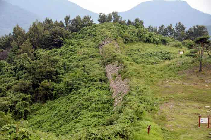
Malosanseong Fortress is located about 3km to the east of Gwangyang city and is 208.9m above sea level, surrounded by the peak of Mt.
Malo in the Baekje era. The fortress is located on both sides of the mountain and low in the middle like a saddle of a horse. To the south, Gwangyang Bay and Suncheon Waseong Fortress, Gwangyang-eup to the northwest, and Namhae Expressway to the south at a glance, and Suncheon Geomdansanseong Fortress of Baekje is located about 6.7km to the southwest. It was a strategically important location because it was close to the sea.
Around the 6th century, when Baekje established a capital in Gongju (Woongjin), it built the first fortress to rule Maro Prefecture and used it until the Unified Silla Period.The records of Malo-hyeon write that Gwangyang was Maro-hyeon in the Baekje period in Sejong Silok Geography and Sinjeungdonggukyeoji Seungram.


The size of the castle is 550 m in circumference, 5.5 m in width, and 3 to 5 m in height of the outer wall, and includes earthenware, iron and bronze ware from the Baekje and Unified Silla eras, as well as prestigious tiles such as ‘Maro-gwan’ and ‘Military Service-gwan’. As a result, a large amount of roof tiles were excavated.
| Name | Gwangyang Marosanseong Fortress 光陽 馬老山城 광양마로산성 |
|---|---|
| Address | Mountain 78 and 1 in Yonggang-ri, Gwangyang-eup, Gwangyang-si, Jeollanam-do 全羅南道 光陽市 光陽邑 龍江里 山78 外 1 전라남도 광양시 광양읍 용강리 산 78 외 1 |
| More information | Historic Site No. 492 Area 18.945 square meters |


Add comment